Maiden Head Locator System
(developed by John Morris G4ANB London In October 1979)
(developed by John Morris G4ANB London In October 1979)
We also provide a program to calculate your villages maidenhead Location as well as the distance and direction to village from Athens
How the Maidenhead Locator System works
Each field is divided into 10 * 10 = 100 squares, each one 2 degrees longitude * 1 degree latitude.
Each square is finally divided into 24 * 24 = 576 sub-squares, each one 5 minutes longitude * 2.5 minutes latitude.
The fields are indicated by 2 letters AA - RR, the squares by 2 digits 00 - 99 and the sub-squares by 2 letters AA - XX. The first character is the longitude character and the 2nd character is the latitude character on each level.
The numbering direction is everywhere West to East and South to North. The complete locator is the sum of all 6 characters, for example 'FN43MJ'.
Recommended abbreviation for the word 'locator' is 'loc'.
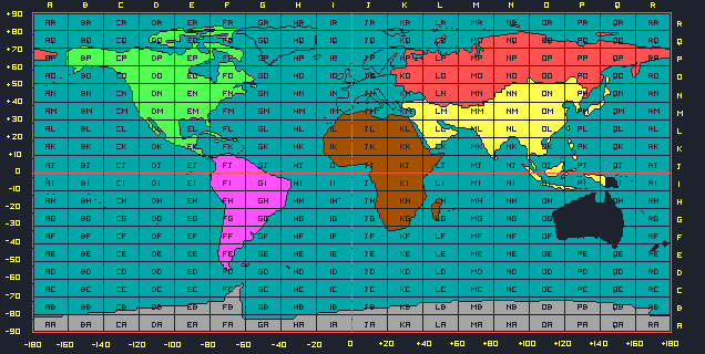
The world is divided into 324 Large Squares (From AA to RR or 20degrees by
10degrees)
Each of these squares has a two letters (Greece is in KM and KN)
Each of these squares has a two letters (Greece is in KM and KN)
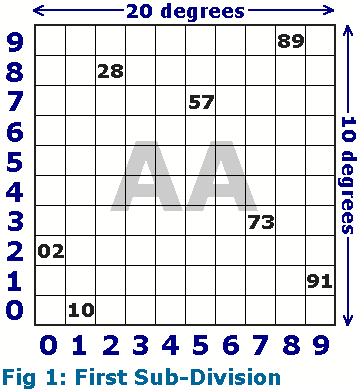
Each of these original squares are divided into 100 smaller squares (wint
numbers)
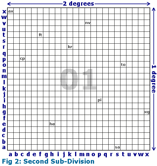
Each of these smaller squares are duvided into 576 even smaller squares (with
two letters)
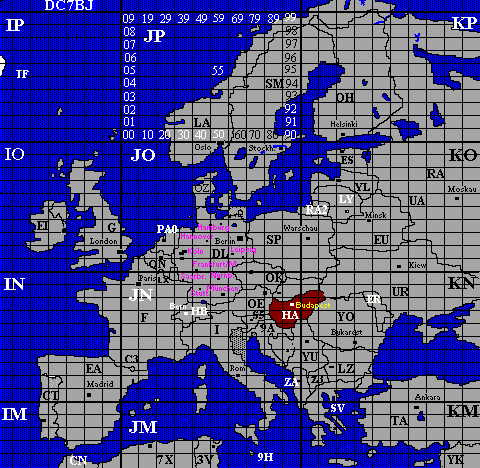
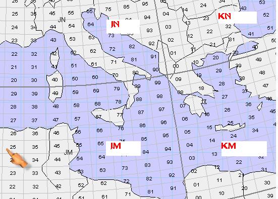
Greece is situated in the cells KN and KM